
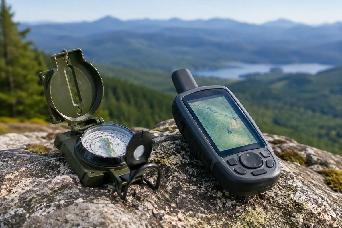
A navigation device that has worked perfectly on a marked trail can become a liability when batteries are flat, the screen is obscured by rain or the route leaves obvious ground. The military compass vs GPS decision is not about choosing old kit over new. It is about knowing what each tool does well, where it can fail and what belongs in your navigation system.
For military personnel, cadets, patrol teams and serious outdoor users, the most dependable answer is usually to carry both. A GPS gives speed, position and useful route data. A quality compass and paper map provide an independent method that needs no signal, charging lead or software update.
Military Compass vs GPS: the working difference
A military compass gives direction relative to magnetic north. Used with a suitable map, it allows you to take bearings, orientate the map, follow a planned route and relocate yourself from terrain features. It is simple equipment, but accurate work relies on sound drills: correct handling, careful bearing-taking and an understanding of grid north, magnetic north and local magnetic variation.
A handheld GPS receiver calculates position from satellite signals and displays it as coordinates, usually alongside a map, waypoint or track. It can show distance travelled, height, estimated arrival time and a route back to a known point. This is a considerable advantage when moving quickly, navigating at night or recording a route for later use.
The key distinction is that a compass helps you navigate by judgement, while a GPS provides a highly useful position fix and digital reference. Neither replaces the need to read the ground.
When a military compass earns its place
A proper military-style compass is not dependent on battery life. That is its first and most obvious advantage. It remains available after days in the field, during cold-weather work when battery performance drops, or when a device has been damaged, misplaced or simply not charged.
It is also a better training tool for understanding navigation. Working from a map and compass forces the user to assess contours, linear features, handrails, attack points and likely hazards. You build a picture of the ground before setting off rather than following an arrow on a screen. In feature-rich country, this makes it easier to spot a small error before it becomes a major detour.
A compass is particularly useful for:
- orientating a paper map and maintaining direction between identifiable features;
- plotting and following a bearing in low visibility, woodland or open moorland;
- estimating location through resection when you can identify features around you;
- providing an immediate backup when electronic navigation is unavailable.
Choosing the right compass pattern
For general map work, a transparent baseplate compass is practical because it is easy to lay over a map, plot a grid bearing and measure distance against the map scale. A sighting or prismatic military compass is better suited to taking accurate bearings onto distant features. Many experienced users favour a robust military pattern for field use, but it needs practice to get the best from it.
Whichever style you carry, check that the bezel turns cleanly, the needle settles freely and the luminous markings remain usable. Treat the compass as precision kit, not a decorative addition to a rucksack.
Where GPS is the better tool
A good GPS receiver is faster for confirming your position. When time matters, being able to check a grid reference, see your track and verify the next waypoint can prevent small navigation errors from consuming an hour. This is valuable on long routes, unfamiliar ground, wide-open terrain and night movement.
Modern handheld units also handle data that would be awkward to manage with map and compass alone. You can load planned routes, mark water points, record tracks, calculate distances and retain a clear record of where you have been. For security teams, expedition groups and airsoft sites with defined boundaries, this can make planning and debriefing more efficient.
GPS is not infallible. Satellite reception can be reduced beneath dense tree cover, in steep-sided valleys, around buildings or under certain weather conditions. More commonly, the failure is human: the wrong map layer, an incorrectly entered waypoint, a mismatched coordinate format or overconfidence in a route line that does not account for fences, rivers and restricted ground.
Battery management is the operational concern. A handheld GPS with a bright screen, active tracking and mapping will use power quickly. Carry spare batteries or a protected power bank where appropriate, keep the device warm in cold conditions and reduce screen brightness or tracking frequency if you need to extend runtime. A waterproof case and secure lanyard are sensible additions, not luxuries.
Coordinate systems must match
A GPS position is only useful if it matches the map and the rest of the team. In Great Britain, users often work with Ordnance Survey grid references, while devices may also display latitude and longitude. Before moving, confirm the coordinate system, datum and grid reference format. A six-figure grid reference entered as an eight-figure reference, or a waypoint set in the wrong format, can put people a long way from the intended point.
This is one reason a paper map remains valuable even with a capable GPS. It gives the wider picture: contours, alternative routes, likely obstacles and the relationship between your position and the terrain around it.
Accuracy is not the same as reliability
GPS is generally more precise for establishing a position, often to within a few metres under favourable conditions. That does not automatically make it the more reliable navigation method for every task. Position accuracy does not tell you whether a route is safe, passable or tactically sensible.
A compass bearing may be less precise over a long distance, especially in strong wind, darkness or featureless ground. Yet it remains dependable when used alongside a map and deliberate distance estimation. Pacing, timing and terrain association are still worthwhile skills because they work when a screen cannot.
Think of reliability as a chain. The GPS needs satellites, power, correct settings and a user who understands the display. The compass needs a map, correct magnetic adjustment, a known start point and competent technique. Carrying both avoids placing the whole chain on one item of equipment.
A practical field setup
For most UK training, hillwalking, expeditions and tactical events, take a current waterproof map, a dependable compass and a handheld GPS or suitable mobile phone-based navigation application. Keep the map accessible in a case rather than buried in the pack. Keep the compass on a lanyard or in a consistent pocket. Protect the GPS from knocks and wet weather, and carry enough power for the duration plus contingency.
Before departure, set your map, compass and GPS to compatible references. Mark essential points, such as start locations, RVs, water sources, vehicle access and emergency egress routes. Then confirm that every member of the group understands the route well enough to continue if the primary navigator is separated from their device.
Do not use a mobile phone as the sole navigation plan for remote ground. It can be an excellent supplementary tool, particularly with offline mapping, but it is more exposed to battery drain, screen damage and loss. A dedicated handheld GPS is usually better suited to prolonged field use, while map and compass remain the fallback that should never be left behind.
Which should you buy first?
If you are still learning navigation, buy a quality compass and current mapping first, then learn to use them properly. The skill transfers across ground, weather and equipment. Once those fundamentals are in place, a GPS adds speed, confidence and planning capability without becoming a crutch.
If you already navigate confidently and need accurate tracks, waypoint management or reliable position checks on longer days, a dedicated GPS is a worthwhile addition. Choose a unit with controls you can use with gloves, readable mapping, good weather protection and batteries that suit your intended use.
The best navigation kit is the kit you can operate calmly when conditions are poor. Practise with the compass before you need it, learn the settings on the GPS before leaving the vehicle, and keep a paper map close at hand. That preparation is what turns two useful tools into dependable field capability.